
How healthy are our rivers?
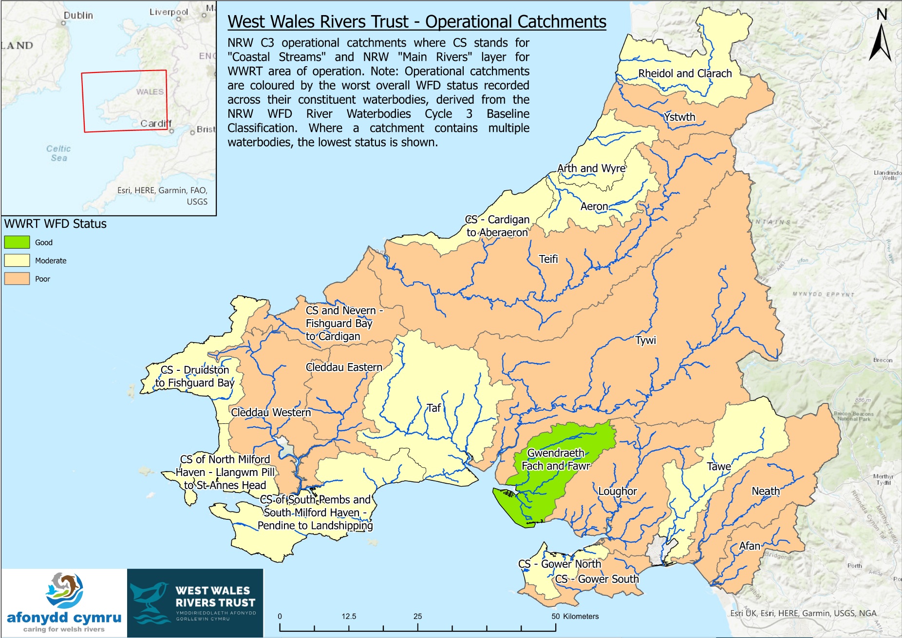
The map shows the overall ecological status of rivers across the West Wales Rivers Trust area, based on the Water Framework Directive (WFD) classification. It highlights where river catchments are in good, moderate or poor condition, helping to identify the areas where action is most needed to protect and restore our freshwater environments.
Note: Operational catchments are coloured by their worst overall WFD status – where a catchment contains multiple waterbodies, the lowest status is shown.
For further health data for specific rivers, please see our River Factsheets page.
Do you know how to spot pollution in our rivers and beaches?

Often it can get confusing on what is and what isn’t pollution, so we’ve teamed up with organisations across Pembrokeshire and wider West Wales to bring you this guide on what not to and what to worry about!
It’s crucial that accurate reports are sent to our government environment agency, Natural Resources Wales so that we can build an evidence base and the most urgent cases can be responded to as soon as possible.
Click the links below to view our new guide, and thank you for caring about our water environments!